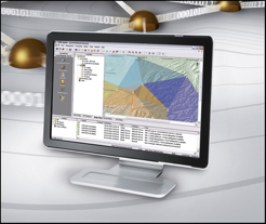
Leica SpiderQC is a multi-purpose GNSS data analysis tool that can be used for:
SUITABLE FOR ALL GNSS REFERENCE NETWORKS
Leica SpiderQC processes GPS (including L2C and L5), GLONASS, BeiDou and Galileo (including AltBOC) data in the standard RINEX format that is supported by all leading reference station software. Leica SpiderQC is the perfect companion for all reference station networks. It allows the network operator to monitor the quality of the network in an efficient manner.
SITE ASSESSMENT
Leica SpiderQC helps you to select the best location for your reference station. Use it to evaluate code and phase multipath, check for RF interference and signal attenuation, measure data quality and completeness and much more. Use the Quality Check feature for verification of the quantity (tracking information, data gaps), quality (cycle slips, multipath, SNR) and the format (compliance to the RINEX standard) of your GNSS data.
AUTOMATED ANALYSIS OF GNSS REFERENCE STATION DATA
Reference station networks generate vast amounts of data. To make a detailed analysis of this data is not possible without sophisticated analysis and reporting tools. Leica SpiderQC offers a comprehensive suite of tools tailored to the inspection, alarming, display and distribution of quality data relating to the raw data products of a reference network.
NETWORK RTK PERFORMANCE MONITORING
The Network Online Visualisation of Accuracy (NOVA) feature of Leica SpiderQC enables you to visualize the spatial and temporal quality of the single base and network RTK positioning over your network. Real-time maps show the distribution of residual ionosphere and troposphere/orbit error enabling you to monitor the network status and identify problem areas in the network. Network users can view the maps over the web to get assurance on the quality of the corrections provided by the network and to decide between using the nearest site and network RTK corrections for the specific location of their survey.
REFERENCE STATION INTEGRITY MONITORING
Using Leica GNSS Spider Real-Time Positioning or a fixed rover in your network, Leica SpiderQC can monitor the quality and availability of corrections from the network. Statistics such as accuracy, precision, availability, reliability and more can be used to quantify the integrity of the service and warn if thresholds are exceeded so corrective action can be taken.
DEFORMATION MONITORING
Detect and visualize movements of your reference stations or other critical infrastructure. Leica SpiderQC integrates with a variety of high speed real-time and post-processing positioning engines including Leica GNSS Spider and Bernese and any other software supporting standard NMEA and SINEX formats.
Detect and visualize movements of your reference stations or other critical infrastructure. Leica SpiderQC integrates with a variety of high speed real-time and post-processing positioning engines including Leica GNSS Spider and Bernese and any other software supporting standard NMEA and SINEX formats. High precision tilt measurements from Leica Nivel 210 inclination sensors can be used to complement the GNSS derived data.
LIMIT CHECKS AND MESSAGING
Three levels of absolute limit checks for each of the longitudinal, transverse, height, 2D and 3D displacements, 2D accuracy, height accuracy, availability, x-tilt and y-tilt may be defined separately for each monitored site. A flexible messaging system allows for the configuration of email, SMS, and command-line actions to be linked to each limit check and system message. The current connection and traffic light status of each site/sensor/solution are shown.
INDUSTRY STANDARD DATA FORMATS
Leica SpiderQC works with standard data formats including RINEX (2.x, 3.x), SINEX, IONEX, and NMEA GGA, GNS, GGQ and LLQ in addition to proprietary Leica formats. TCP/IP, serial and SQL database communication links are supported. A direct link between Leica SpiderQC and Leica GNSS Spider and Leica SpiderWeb makes the configuration of the system quick and easy.